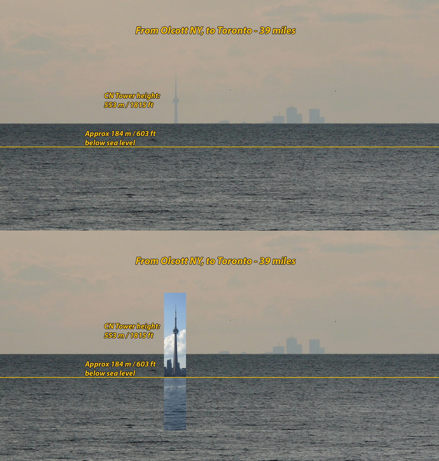
This is a photo of the Toronto skyline taken from Olcott, New York (elevation around 30 feet above the lake) about 39 miles away.

Question is: where is eye level?
If you can, please draw a line in paint or photoshop and repost the picture.
PS You may want to bear in mind the following:
1. When pictures are posted showing that the horizon appears to be below eye level, flat earthers tend to state that the horizon is obscured by haze, and that the horizon would actually be at eye level - ie, level with the horizontal red line in the picture below - but we just can't see it.

2. When pictures are posted of distant skylines obscured by water, such as this one:

flat earthers tend to state that it's actually waves or haze that's obscuring the bottoms of the buildings.
The interesting thing about this, though, is that #1 puts the actual flat earth horizon
above the horizon in the photo, and #2 puts the actual flat earth horizon
below the horizon in the photo.
(To explain #2: the photographer was 30 feet above the lake. The lower 600 feet of the CN Tower is hidden. Therefore 30 feet above the lake
on the Toronto side - which must also be at the same level as the photographer - ie, "eye level" - is quite some distance
below the horizon in the picture.)
"Eye level" - and therefore "the actual horizon" - can't be both
below and
above the horizon we see in the photo
at the same time.
This is especially obvious if we imagine a photo which both includes a way to measure eye level
and a view across water to a distant skyline.
Something like this:

So, given that "eye level" is not that difficult to calculate, discover, and draw, where is eye level in this pic?
