Show Posts

This section allows you to view all posts made by this member. Note that you can only see posts made in areas you currently have access to.


Messages - SiDawg

Pages: < Back  1 2 3 [4] 5 6 7  Next >
61
Flat Earth Theory / Re: The Electromagnetic Accelerator
« on: May 28, 2018, 05:42:41 AM »
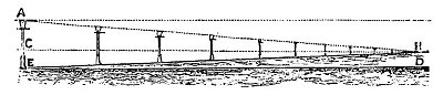
Also, why is this effect described as "light bending upwards"... If you take your sun as an example, rather than light going straight to the viewer, it is being pulled DOWNWARDS... If you're looking at an apparently "image" of the sun in the distance at 5pm and it appears a lot lower then it really is, then the light is being pulled downwards right?

And we know perspective doesn't just work on objects above us... for example, if you were looking at a sun set, you could lie on your side right? So any curving effect would happen in any direction, like i've drawn above yes? So it's not really about light curving "downwards" it's more about light curving "inwards" on an image plane where the observer is in the middle of that image plane?

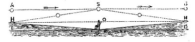
And if you believe there's some sort of "force" that's bending the light, then if there's two observers standing 100 meters besides each other, towards which observer will the light curve? They'll obviously get a different "perspective" view as they're in different positions, but with this "light curving" theory of flat earth, how could the light curve in different directions and amounts for different viewers?

So it wouldnt be a "universal" force equal for both viewers, but a completely subjective force depending on the viewer? So our brains decide how to curve the light? Or does god decide how to curve the light uniquely for each person? Then how come cameras see light curving differently for different objects? Are our cameras alive too? Does god love cameras?

62
Flat Earth Theory / Re: The Horizon is Always at Eye Level
« on: May 28, 2018, 05:31:01 AM »
Hi I don't quite follow your logic with the islands appearing about the horizon... Again, I'm playing devils advocate (folks are going to think i'm a flat earther soon!)

But if horizon rises to eye level, they will surely just say that the islands along that line can have their tops above eye level? (the and first top above the bottom of the second top)


63
Flat Earth Theory / Re: Guide to Creating a Flat Earth Map
« on: May 27, 2018, 01:12:35 AM »
I haven't cut every cake in the world but I know they can all be cut in to eight slices :P

360 degrees is essentially an "arbitrary" mathematical decision to split a circle in to a number of even parts. We know that the number "360" exists, and we know a concept of "equal" so we know can make 360 equal divisions...

If we take three cities which are each on consecutive latitude lines, 30, 45, and 60 degrees: the question is not whether those lines are an equal distance apart, the question is are those cities actually on those points and are those cities an equal distance apart.

So yeah if those distances are in doubt then the way they constructed the graph is in doubt, however i would suspect that if you start with the opposite assumption, and assume that all the lines should intersect, then that would give you a "ratio" of distance between different spots on the earth. I suppose as the OP i have to go away and do that work myself dont I lol argh i can't really be bothered... Anyone else? But I'm assuming it's going to show us things like "the distance between france and london is the same as london to new york".... and us REers will say "that's crazy, we know thats not true, the world is not flat" and the FEers will assumedly say "well we know the world is flat, so that must be the true distance", if we get to THAT point... then we can begin to construct a flat earth based on those distances right? (at which point i'm guessing the FE will just say "how do we know those original measurements were correct"...

It would really help if there was a consensus between flat earthers about an acceptable method to measure distance, and thanks Edby for proposing the triangulation method... That's the sort of thing yall need to agree on, and then go out and do. That would require quite a bit of time though so I'm thinking it will be hard to get off the ground. There's no point RE doing the work as it won't be believed :D

64
Flat Earth Theory / Re: Guide to Creating a Flat Earth Map
« on: May 26, 2018, 08:52:10 AM »
To play devil's advocate, i don't think he's saying that a degree isn't a degree, but saying that the land positions that we accept as being a certain distance apart arn't necessarily at that distance. In other words, it's not that the longitudinal distances aren't a certain fixed distance apart, but more that the location of cities on those longitudinal lines isn't known.

What would be interesting is taking all those lines from the initial experiment, and "forcing" them to line up to a certain arbitrary point. That should then give you some supposed distances, or ratios of distances, between different points. That should be suitable to either start to draw a flat earth map, or in itself prove the impossibility of a flat earth map

65
Flat Earth Theory / Re: The Electromagnetic Accelerator
« on: May 26, 2018, 06:43:34 AM »
Something like this maybe? If light isn't shining directly in to our eyes, but curving, then it must be curving on to some sort of image plane right? And then the image from that plane enters our brain "somehow" and opening and closing our eyes just turns that image on and off? It's not actually light entering our eyes at all? Help me out here people!

66
Flat Earth Theory / Re: The Electromagnetic Accelerator
« on: May 26, 2018, 02:57:34 AM »
It's really hard to know where to start with this. There's a very simple drawing showing the path of light from the sun, in one side view. What about every other object we're looking at in the room we're sitting in?

I have a very hard time knowing how to even begin to flesh out that concept, let alone refute it. Can someone please explain how i might even attempt to show why a scene appears like below using "curved light"? Perhaps that's my own confirmation bias: I would start by drawing a point representing where my eye is in the top and side view. But once i do that, then the explanation of how the perspective view forms is inescapable to me. I mean, how can i draw a curved line towards the second post when it's obviously a straight line towards my eye? A real head scratcher! If this curved light idea is such an elegant simple concept that it can be drawn as the top image with a sun and curved light, then surely the same can be done with my very simple train yard scene?


67
Flat Earth Theory / Re: Guide to Creating a Flat Earth Map
« on: May 26, 2018, 02:16:55 AM »
We do have models which involve bending light
[...]
There are also a lot of assumptions about [...] how perspective works.

On a scale from 1 to 10 how would rate the "assumption" level of a) perspective as a result of angles towards a focus point and b) perspective because electromagnetic waves are curved?

Scale 1 = completely unquestionable fact, 5 = some evidence but still some questions, 10 = pure speculation without any evidence

68
Flat Earth Theory / Re: Guide to Creating a Flat Earth Map
« on: May 25, 2018, 02:03:40 AM »
Again, i think of the jumping frog example... A frog is trying to cross a river. It can jump half the distance each time. i.e. in it's first jump, it crosses half the river. In it's second jump, it crosses half the remaining distance to the bank.

Obviously the frog will never actually reach the bank, but you can still draw the path he will take... it just looks like a line from one bank to the other yes?

This is what a perspective line is! As objects get "smaller" in the distance, they also get closer to the vanishing point by a smaller amount... i.e. a train track: the gap between the near sleepers looks quite large to you, but as the track goes in to the distance, the gap between the sleepers gets less and less yes?

Objects disappearing in to the distance are just like the frog: they get closer and closer to the "vanshing point", the other side of the river, but they never reach it, because each time they 'jump', it's a fraction of the remaining distance...

So yes, "kind of", perspective lines meet, but you have to surely realise that they meet at an infinite distance: this is very simple geometry.

69
Quote from: https://wiki.tfes.org/Magnification_of_the_Sun_at_Sunset#Lamp_Post_Example
Q: Shouldn't the sun get blurrier if it is being magnified?
A: The sun actually does get a bit fuzzier when it is at the horizon compared to overhead at noonday.

Q: Shouldn't polarized sun glasses or a welding mask be able to restore the sun to its actual state?
A: The explanation is describing a projection upon the atmoplane. The projection is appearing upon a medium between the source and the observer. Polarized sun glasses or welding masks are useful for reducing internal glare lens effects within the eye; but would only darken the scene in this external situation.

It's handy they've provided answers, but they're completely nonsensical. For a start, "a bit fuzzier" is a HUGE stretch from "a tiny point of light somehow becomes the same size disc as it was at noon, with MINIMUM, 1% or less blurring effect".

What is a "projection upon the atmolayer" ?? A projection requires focus on to an image plane. Light through gas is not focusing on anything: light rays are scattering, not converging. It's interesting they give a laser as an example: further proves the RE point. A laser from 1cm shows a single point... a laser diverging at 10m shows a bigger "point", and A LOT fuzzier, when projected on to, say, a wall... there's no "focus" to it at all. It's not as if it's focused for 9cm then fuzzy for the remaining 1cm... it's completely fuzzy.

If you point a laser directly at someone 10m away, they will see the single point in the middle...(or more to the point, they will get a single point burnt in t otheir retina!) they may notice a slight "haze" surrounding it but the majority of the light they see is from the centre point. Try the same with your phone: torn the torch on, hold your phone a meer 5cm from the wall and it projects a pretty huge circle even at that distance: close to 5cm wide on my S8 anyway! Now the hold the phone pointing the torch towards you... 5cm, 10cm, hell even 30cm away from you: do you see a giant 30cm disc of glowing light?? No: you see a very bright spot coming from where the torch is. Their laser light is example is beside the point: obviously the lamps in the photos are illuminate a much larger area than the "orb" of light you can see in the photo, so the laser light example is irrelevant.

Hold your phone in front of your face with welding glasses: because the centre of the light, the light source, is the brightest point, regardless of all the scattering that occurs, the brightest point by far is still the light source. This is where the greatest concentration of light rays, with the greatest intensity, are coming directly towards your eye. The "orb" of light emanating from the torch, is no longer visible, only the light source, and it's true size. Perhaps I need to demonstrate this with photography. It's quite easy to do: just use faster shutter times or smaller apertures.

Perhaps this argument can be won by simply sending flat earthers pairs of welding glasses?


70


ENAG shows this representation for how humans perceive objects disappearing in to the distance towards a vanishing point (drawing perspective lines to show the effect):


It follows that one can also draw a perspective line on the bottom of the lamp, as it clearly follows the same rules: in other words, the lamp post gets smaller, and the actual lamp 'head' gets smaller, as clearly shown in the diagram:


ENAG then goes on to show how the sun sets because it too approaches a vanishing point:


However, in this image, they have either forgotten or failed to show the size of the sun descreasing, just like the head of the lamp does


Is there some "exception" rule for the top image vs the bottom image? Is ENAG choosing not so show the sun shrinking for the purposes of the diagram? Given the diagram is meant to describe what we see in reality, then which version is more correct in reality? When you view a lamp in the distance, does the light/head part of the lamp stay exactly the same size while only the post shrinks to the vanishing point?

ENAG is saying in the top image, that images shrink towards a vanishing point, yet it's also saying that objects DON'T shrink towards a vanshing point in the bottom image, and that somehow light can hold information about what should shrink and what shouldn't shrink? Aparently the height of an object can shrink without the object itself shrinking? If the top of the lamps had their posts removed, and were sitting on the ground, would they not still shrink in the distance? How are they any different from the sun: the sun is just a lamp without a post, yes?

All base images from 'ENAG' courtesty "Zetetic Astronomy - Earth Not a Globe" (ENAG), by 'Parallax' (pseud. Samuel Birley Rowbotham), [1881], at sacred-texts.com. Red lines added to images but all rights retained as per original

71
So this is what we know:

  • Parallel lines never meet
  • Parallel lines or objects, as seen through the eye (or a camera lenses) will be "angled" towards a vanishing point
  • The vanishing point is an infinite distance away
  • Distance objects appear smaller in our field of vision because all images are focused to a point inside our eye
  • At a certain distance, the eye can not discern whether two parallel objects are still separate or not

This is what flat earthers "know"
  • Distant objects appear smaller for some reason
  • At a certain distance, the eye can not discern whether two parallel objects are still separate or not
  • I can see the sun disappear, therefore that must be the point where two parallel paths meet the vanishing point
  • I can't draw a scale drawing, but I can draw a representation of that, by drawing a diagonal line for the sun and the earth and showing them meet somewhere
  • I know I don't have to provide any more thought behind that because I'm happy with what ENAG shows me

The facts behind how perspective work are compatible with the flat earth "simplified representation" of how perspective works. Drawing representations of things is an important part of relaying information and teaching new concepts to people, provided they KNOW it is just a representation, and KNOW where that representation falls down. Flat Earth doesn't seem to be able to make that leap.

It is demonstrably, mathematically, and logically impossible for three parallel lines to reach a vanishing point independently... That is essentially what they're saying. There are three parallel paths: the ground, the bottom point of the sun, the top point of the sun. If the bottom point of the sun is parallel with the earth, then the top point is ALSO parallel with the ground. If the bottom point of the sun appears to meet/touch the earth, then the top part of the sun would meet/touch the earth at exactly the same point. As the bottom point of the sun gets closer and closer to that point, then the top point of the sun also gets closer and closer to the same point. Ergo, the top point and bottom point should meet at that point, and should appear to be getting closer and closer to that point as they approach it. In other words: the sun would shrink to a single point.

72
Flat Earth Theory / Re: Guide to Creating a Flat Earth Map
« on: May 23, 2018, 02:05:00 AM »

That link is assuming certain things about perspective and the infinite nature of perspective lines. "How it should operate on a Flat Earth" -- Hogwash. Those people either have not read Earth Not a Globe, or have issues with reading comprehension. The perspective lines are treated to intersect a finite distance away, not an infinite distance away.


We don't need to "assume" anything about perspective: we KNOW how perspective works. This is how it works https://forum.tfes.org/index.php?topic=9513.0

What element of that are you saying is not true? It shows you EXACTLY what a "perspective line" is and what it represents... yes mathematically they "kind of" intersect, but at an infinite distance... so for all intents and purposes, they never intersect.

73
Flat Earth Theory / Re: Guide to Creating a Flat Earth Map
« on: May 21, 2018, 02:37:59 AM »
Is there an authoritative source for shipping routes/distances that can be used? Or is it just a case of using GPS with the equipment on board an individual ship... i mean i guess there's not really a need to post that stuff back on to a database right? GPS is effectively better than such a database (i.e. trusted live data)

74
Flat Earth Theory / Re: Guide to Creating a Flat Earth Map
« on: May 21, 2018, 12:55:59 AM »
Yeah that's a nice idea. Perhaps it requires a website, to coordinate such world wide effort, and code an easy way for participants to submit their finding.

Was also wondering: could short wave radio be used to measure distances? There'd no doubt be a bit of variance from atmospheric conditions, but I'm thinking the precision would be less than using flight times/plane speeds. Would also require a large amount of coordination, and not many people have short wave radios... might be able to get the SWR community interested though. I wonder if internet calibrated clocks would be accurate enough. Apparently light circles the earth about 7.5 times a second... the cities i've chosen (and can be changed) are roughly 60 degrees apart, so light/EM radiation would take about 22ms to travel 60 degrees (plus a bit more once it goes up, bounces of ionosphere, bounces back again). That's reasonably "slow" in the grand scheme of things but maybe the combination of clock accuracy and atmospheric conditions would make the data essentially useless hmm

Another method i was thinking of: we have access to a huge database of images of land (i.e. google maps). If the "great round earth conspiracy" is ensuring that google map images are stretched or skewed away from flat earth "reality", this can surely be measured using known lengths? We could use cars for example: you could get an average length of a car, and use that to "calibrate" any google map image, or confirm that the image isn't being stretched or distorted. If you've confirmed it hasn't been stretched or contorted, you can also use the same cars to provide an accurate length of distance for each image... Do that enough times from place to place and you have a another method of measuring distance. Again, a lot of margin for error in such a calculation, as most google map images only have a resolution of half a meter or so, plus relies on populated land between each location. In order to prove the globe earth I think the most useful distances will be between Africa, South America, Australia, and pacific islands, so that makes that a bit useless.

Or we could of course just use "known driving times"... You can use google street view to get distances from signs: gather enough data, they can't ALL be wrong...

Or use shipping distances and times: but as we've seen on this site, direct evidence from people on board such ships is tossed aside.

75
Flat Earth Theory / Guide to Creating a Flat Earth Map
« on: May 15, 2018, 05:39:24 AM »
It's commonly accepted by Flat Earth believers that there's no known map of the flat earth. The "Azimuthal Equidistant Projection" often used is just a conceptual image, it does not reflect reality, just a rough idea of what the flat earth might look like (and by "might" i mean, it's normally accepted that it's something OTHER than that map...)

So how would one go about constructing an accurate map? Obviously navigating coast lines and recording in to journals is a pain staking expensive process. But what I propose is to start with a very very simplified basic map:

Lets construct a Flat Earth map using only 12 points

For those 12 points, let's use these known cities:
  • Cape Town
  • Kinshasa
  • Stockholm
  • Beijing
  • Jakarta
  • Perth (West Australia)
  • Anchorage (Alaska)
  • Honolulu
  • Auckland (New Zealand)
  • Montreal
  • Panama
  • Buenos Aires

So question now is: how can we determine the true distances between these cities? And that's where I'm curious what Flat Earth believers think would be an acceptable method. I know "flight times" have been raised and rubbished (i.e. seen as "skeptical") a number of times, but surely there's a logical/mathematical way to still use that data? For example, theoretically planes could "lie" to us and be travelling very slowly, in order to make distances seem longer than they truly are. Plus planes can use "slipstreams" so they can go much faster than their reported specs.

I'm curious what, if any, aspects of plane data Flat Earth believes will accept? Do you accept published maximum/minimum speeds of planes? Also, do you accept the reported speeds of winds (slipstreams) in the upper atmosphere?

If you accept that data, then that will give us "maximum" and "minimum" distances for each reported flight time between those cities. That should give us a "rough" possible map of the flat earth right?

76
Flat Earth Theory / Re: The Horizon is Always at Eye Level
« on: May 14, 2018, 03:11:39 AM »
You're showing us a diagram, how can anyone just believe in this diagram. How would I know this is what happens.

Huh? What ELSE would happen? You don't need to BELIEVE in a diagram, it's representing what we know to be true... Feel free to draw your own diagram

77
If planes aren't in orbit than RET is wrong, because in RET everything is always in orbit around something else. In RET, a plane would be in orbit around the Sun, just like the rest of the Earth. How are you supposed to defend RET if you don't even understand your own rules?

By that logic, if a butterfly flaps it's wings in Japan, then we have to account for that in every other scientific experiment, and if we don't, then we don't understand how butterflies work. If we don't understand how butterflies work, how can we possible defend anything!

You could quite easily calculate the forces of gravity on a plane from the sun, the moon, mars, jupiter, polaris, anything you want. But it's obvious those forces are negligible... By far the most important forces for a plane are gravity (towards earth), lift, thrust, and air density i.e. resistance to that thrust. The earth is really really really heavy... a plane is not. Given the atmosphere moves with the earth, and planes exist in that atmosphere, that's all the plane cares around.

In one way, as a complete system, then yeah everything on earth is in orbit around the sun. But that's just one way of looking at it. The atmosphere is tiny... roughly one millionth of Earth’s mass... so is the atmosphere orbiting the sun? Erm, in some ways, but for all intents and purposes, it's the solid mass of the earth itself which is in orbit around the sun. Everything else is just "hanging out" and hardly gives a crap about that orbit. The atmosphere, and planes, only care about gravity towards the earth. If you shot a plane in to space at the same distance as the earth from the sun (and nowhere near the earth), it would very slightly be attracted to the sun but just end up flying away for every. So obviously no, a plane is NOT in orbit around the sun... the only thing that's keeping it in roughly the same path as earth's orbit is that the plane is being pulled towards the earth and affected by the atmosphere.

The only thing that's keeping the atmosphere on the earth is the gravitational pull towards the earth: the atmosphere is not in orbit around the sun, it just follows the same path as the earth's orbit around the sun. So yes: from a simplistic "path" point of view, everything is on the same path as the earths orbit, and for the sake of argument, most people would just say "everything orbits the sun". As for "everything orbits something else".... that's not a universal law, i.e. if the universe consisted of only two masses, then they could just be attracted to each other and stick together permanently, or if they were moving for some reason they might be attracted to each other then begin orbiting each other. And obviously our sun formed when objects stopped spinning around something, and were attracted to each other in to one giant blob. But our sun orbits the black hole at the centre of the galaxy.. and apparently our galaxy doesn't really orbit anything: we're on a collision course with the andromeda galaxy. So there's that to look forward to... But yeah, asteroids usually orbit something (usually the sun) or sometimes asteroids from outside our solar system swing by to say hi, usually because they've escaped an orbit from a nearby sun. Things don't HAVE to orbit anything, they just fly around attracted to other masses. If they end up circling that mass, we call it an orbit.

But... getting back to satellites. They clearly couldn't stay in the air without generating "lift" and they can't generate lift without fuel, and they can't get fuel without returning to earth or being refuelled mid air (and obviously no one has ever witnessed that, and pretty sure every single amateur astronomer is not in on the "RE conspiracy"). OK they could be solar powered... but they would then need to be lower enough in to the atmosphere to get that lift from their wings. Satellites are much higher than the atmosphere, so they would need lift from rockets. That requires a lot of fuel.

Plus you realise there are geosynchronous satellites right? So there goes the giant solar wing idea... They would need to just sit there, rockets blazing, keeping them in one position, year after year. Again: amateur astronomers. You should see a blazing stationary rocket during day light, night time, 24 seven.


78
Flat Earth Theory / Re: The Horizon is Always at Eye Level
« on: May 10, 2018, 03:09:09 AM »
Very cool! I would draw a straight black vertical line on both "leveling tubes" and use the point that crosses the liquid as the guide (looks like you've just drawn two lines, one based on the middle of the liquid, one on the edge yeah? But the angle of the camera will affect both of those points). If you draw a line in exactly the same spot on both tubes it should fix that. That level line is crucial so prove you're not pointing "upwards" away from the horizon.

79
Flat earth can't even explain the motion of planets or how the sun is held above the earth... Good on you for "reaching for the stars" but I think dark matter is a bit beyond you (and me)

80
It's hardly fair to expect me to explain how something on your property, which could be anywhere in the world away from me. We've already established there are many methods of technology that could be used. I can't be expected to describe a specific set-up that I literally can not observe.

This is a particularly frustrating cyclic argument...

1 RE: I have a satellite dish to pickup TV
2 Ben: You don't need a satellite dish to pickup TV
3 RE: But i DO have a dish to pickup TV, and if i move it, it doesn't work
4 Ben: I can't confirm that
5 RE: Millions of people around the world confirm it
6 Ben: They don't need a satellite dish to pickup TV
7 Goto 3

Then there's this argument:

1 RE: My dish is receiving signal from satelites
2 Ben: That doesn't prove a round earth
3 RE: But it proves satellites. How do they stay up?
4 Ben: I don't know
5 RE: I do know: gravitational orbiting
6 Ben: Prove it
7 RE: thousands of scientists have proven it
8 Ben: Prove it's not held up by some other method
End argument


Pages: < Back  1 2 3 [4] 5 6 7  Next >