There is also disconfirmation, which is generally a stronger test than confirmation. There is ample data to confirm the RE model. Of course you can always object 'this is not enough', although you need to specify what would count as enough.
There is also data to disconfirm the FE model. You don't need as much as to confirm the other model. All you need is four points on the earth, and reasonably accurate measurement of the six distances between them. Mathematically, this is enough to disconfirm FE.
Even you [Bishop] admitted that latitude and longitude are quantities that can be measured. Once you can measure them, and if you can also measure distances (which we can using a car's odometer), you can get the relationships I mentioned.
Correct. Latitude and longitude are essentially measures of
position. Once you combine these with accurate measurement of surface
distance, you can measure the
shape of the earth’s surface.
An car odometer is a highly intuitive measure of surface distance, although changes in height will lessen its accuracy, plus you wouldn’t expect the combination of rubber and tarmac to give a super accurate figure.
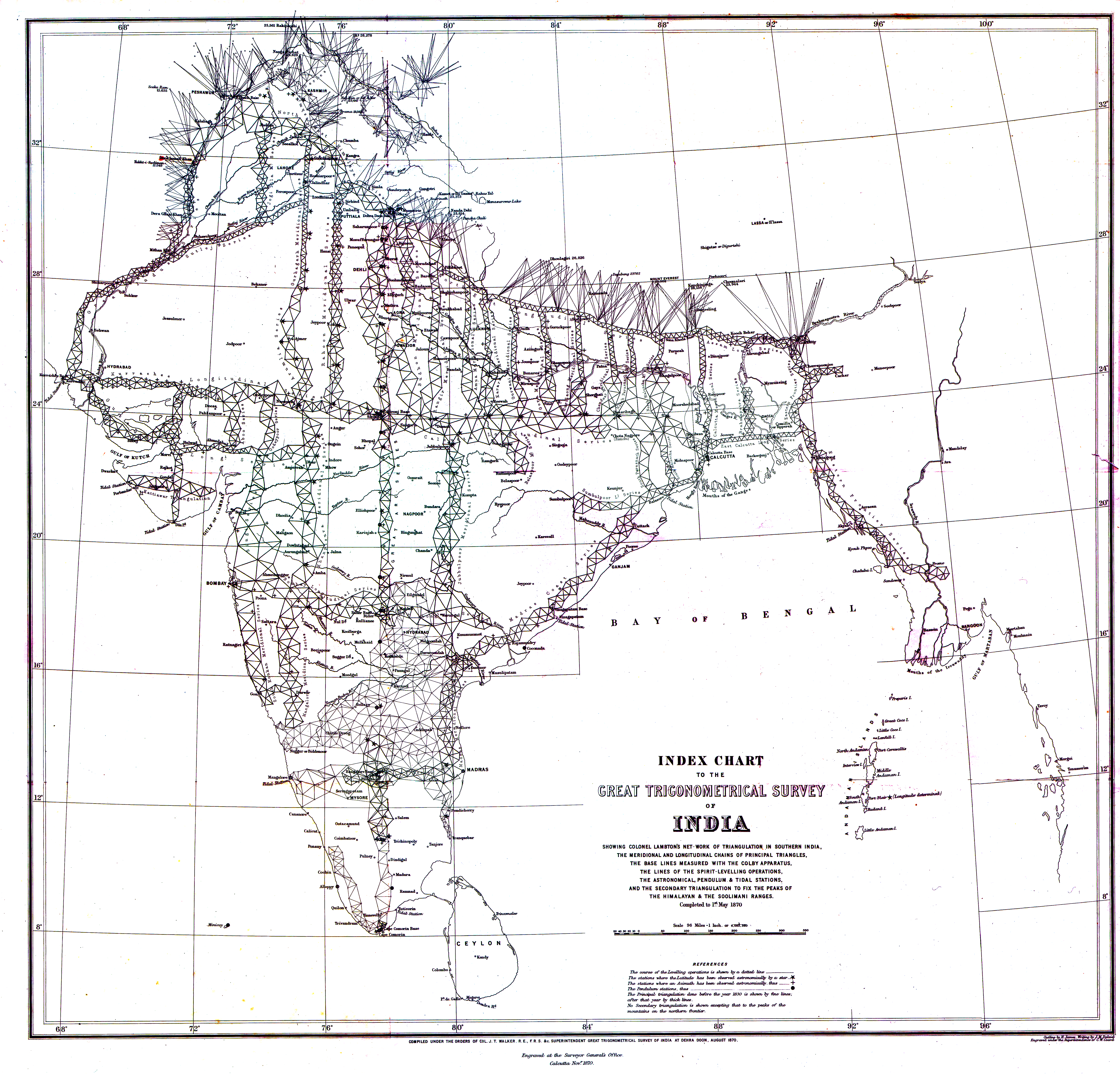
Far more accurate is the system of triangulation which was used across the world from the 18th to the 19th century. Below is a picture of the Indian Survey which took about sixty years. The Shruve Arc was another such survey.
Tom, if you are suggesting there was something wrong with the method used in these surveys, you really need to say what this was. They occupied the time and labour of many thousands of people over hundreds of years, who were all striving for the greatest possible accuracy. What in your view was wrong with the measurement or method?