1
Flat Earth Theory / Re: How do FE proponents explain flying over the south pole?
« on: December 04, 2021, 06:03:38 PM »Well, how about eliminating what you wrote to begin.Ok. Well how about you look the route of one of them up and show how it maps to a flat earth map.Right. Except Pole to Pole circumnavigation trips have occurred.That do not happen to be pole to pole.
Looking at the routes of those, they don’t go straight on at the South Pole
You write, "Pole to Pole circumnavigation trips have occurred."
Immediately after that, you write, "Looking at the routes of those, they don’t go straight on at the South Pole."
Meaning that is not pole to pole.
Obviously, since the maps and charts used were flat, it worked just fine.
Apparently this guy is pretty convinced he flew Pole-to-Pole:
San Diego Pilot Completes ‘Pole to Pole’ Circumnavigation
"San Diego resident Robert DeLaurentis, an aviator and former Navy officer, described his unique journey Wednesday after completing a nine-month circumnavigation from the South Pole to the North Pole to spread a message of peace."
https://timesofsandiego.com/life/2020/08/12/san-diego-pilot-completes-pole-to-pole-circumnavigation/
Pan Am apparently pulled it off too back in '77:
How Pan Am Flight 50 flew from pole to pole
"The one-time-only flight on Boeing's new special performance 747 began in San Francisco, flew over the North Pole and stopped at its next destination: London.
After refueling the plane jetted on to South Africa. Next, it flew over the South Pole and landed in New Zealand before taking off again and ending up back in San Francisco.
Total time: 54 hours, seven minutes and 12 seconds. The record-setting average speed, according to the Fédération Aéronautique Internationale: 487 mph (784 km/hr)."
The route:
https://www.cnn.com/travel/article/pole-to-pole-pan-am-flight-50/index.html
Scomato I believe Satellites exist and fly over all parts of the world. But because of refraction the images may be warped in some instances.
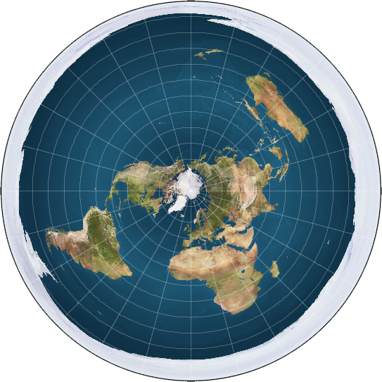
I mapped out Pan Am 50's circumpolar flight on a South Centered FE Map.
Using this information, I don't see why it's impossible for a flight to travel along a Flat Earth and arrive at the same results. Their flight path looks very similar to the "great circle" paths commercial pilots use today (in red). And keep in mind that anybody who arrives at 90'N latitude assumes they are at the North Pole (as per RE Theory).


-Does this presentation of a south centered FE model mean it's now fair game to discuss its logic?
I mean, it opens loads of doors for asking questions regarding a suddenly no longer existing icewall, a continent that is suddenly fairly easy to fly or sail around, new trajectories for the sun and moon, heavily distorted landmasses around the rim of the disc, etc..
To be fair, it would explain why in history sailing the Northwest passage was so hard..