This sunrise taken from Pic du Canigó in late May 2015 in the French Pyrenees with sun rising over the Alps 240 miles away. (Photo credit:
Beyond Horizons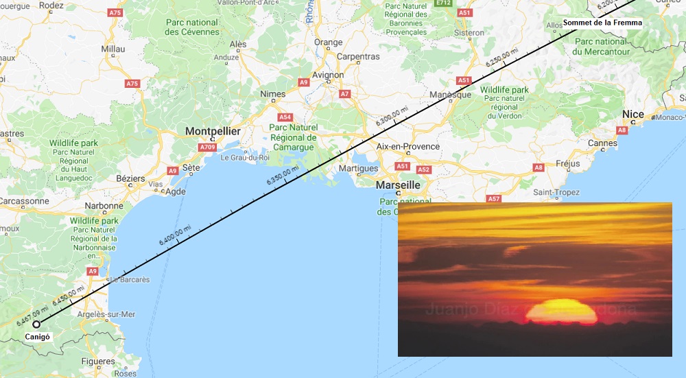
The sun here was overhead the earth over 6200 miles away from Canigó, at a latitude of N19° as it was transiting over the South China Sea.
I got the location of the sun from TimeandDate.Com. How TimeandDate produced that data shouldn't be relevant, as long as there's no controversy over the truth of that data. As long as no one assumes that TimeandDate is using a globe model to derive its data, is everyone -- particularly flat earth proponents -- okay with that resource, or is there another preferred source for sun locating data on a particular date and time?
If there are no objections to the sun data itself, regardless of its deriviation: the three points -- photographer in the Pyranees, peak in the Alps and sun's zenith over the South China Sea -- align using a globe model.

--------------------------
A similar photo was taken a few years earlier by that group; this one of the setting sun over the Pyrenees at a different time of year (February vice May).
This is a photo of the setting sun taken from the plateau below Montagne Sainte-Victoire in south of France, near Marseille.

Taken on February 2nd, 2012 at 17:58 local time.
TimeandDate puts the location of the sun at that time at S16° 50', W71° 05'.

According to the photograph, these points should be in alignment:
Photographer @ N43°31', E05°35' (red star above)
Pic du Canigó @ N42°31', E02°27' (blue star above)
Sun @ S16° 50', W71° 05' (sun icon above)
I can show the alignment on a globe earth:

----------------------
I have not been able to get them to align on any existing flat earth models.
I invite anyone to show me how that can be accomplished.
Or, if not, can anyone explain what incorrect assumption I might be making to expect a model of the earth to plot the alignment we can see in the photographs?