I flew from Los Angeles to Tokyo over the entire Pacific Ocean without any stops. Is that wide enough?
You have no method of reporting what route you actually took.
Even so, the straight line distance between the two points you mention is not all that different from the difference touted between New York and Paris.
Well if all you see during the entire flight is ocean out the windows then you have an idea of the path that it didn't take.
This flight path could possibly account for that trip in which all that you see for 99% of the flight is ocean
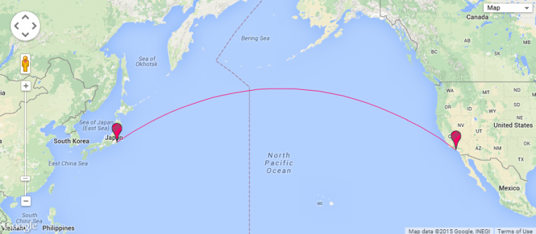
This corroborates pretty much every shipping boat that's traveled between these two nations. You travel west from LA to get to Japan and you travel East from Japan to get to LA.
This flight path says that Tokyo is north, then south of LA.
This flight path takes you north up the west coast, over Alaska, over parts of Russia. Based on the direction of travel, and not seeing Alaska and Russia out of the window I would venture to say this flight path is not the one people are taking between LA and Japan.

The globe is merely the extrusion of the azimuthal.
All maps, from the dawn of time, have been drawn on flat paper
I disagree with this. Google has drawn a map on an interactive sphere.
based on the person doing the drawing being on a flat earth plain.
First paper is a 2d medium. Anything that goes on paper is considered 2d. If someone wanted to make a 3d map they would have to sculpt it, 3d print it, or make some sort of globe.
Secondly I could paint "continents" on a basketball then draw a map of it. I think you can have a 2d map and a 2d surface or a 2d map and a 3d surface. I looked at a map of Colorado 2d but I can assure you Colorado is very mountainous and is not a flat 2d plane.