I don't even know what that would have to do with anything.
That is incredibly obvious.
I do believe that I understand enough about navigation to believe that it should be quite possible to
leave South America exactly on the equator (say at 0°N 80° 6'W) and sail due west till I reach Borneo at 0°N 117°30E, a distance of about 11,200 miles.
But if I do that on the following map I drop off the edge!
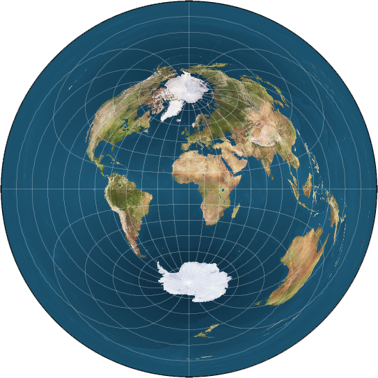
Another alternative model descripting Antarctica as a distinct continent.
There is still an "ice wall" in this model, but it not Antarctica.
Beyond the rays of the sun the waters will naturally freeze. |
So what is going on? This is certainly possible on the globe!
Also, aircraft commonly fly from Los Angeles to Sydney (about 7,500 miles) but on that map you have to fly at least half way around the world.
And please don't try to tell me that flying from Los Angeles to Sydney is done by overflying the USA, Africa and Australis,
they do not do that.Also, don't say that this is that wrong map, as I was castigated in another thread by Tom Bishop when I cited the CHL video and he replied:
"Since the article provides an accompanying illustration using the mono-pole model, it's clearly talking about circumnavigation on the mono-pole model. I see that article as useful for explaining some introductory concepts."