Show Posts

This section allows you to view all posts made by this member. Note that you can only see posts made in areas you currently have access to.


Topics - edby

Pages: [1] 2  Next >
1
Pete is again claiming I have falsified my academic credentials. See here

https://forum.tfes.org/index.php?topic=16802.msg218856#msg218856

Can someone tell him sternly to knock it off, or I will do something about it. Happy to discuss my credentials with anyone privately, but as you see they are stated clearly in my most recent book.

2
Flat Earth Theory / Models vs patterns
« on: January 09, 2019, 12:35:30 PM »
Some Flatearthers like to say that astronomical predictions are merely based on patterns, and that such patterns would exist whether or not the earth were flat. Hence RE = 0, FE = 0. It’s a draw.

But science itself does not measure success in that way. First, science requires an explanatory model. And it rates models in the following way. (1) Prefer a more accurate model to a less accurate one. (2) Given models of roughly equal accuracy, prefer the simpler model to the more complex one. (3) Prefer any model to no model at all.

So, take the pattern we observe of the sun rising, then setting, then a period of near darkness, then sun rising again. This is a well-observed pattern. Then the current scientific model is that this is caused by a relatively stationary sun, with the earth revolving on an axis or rotation. This is more than just noting the pattern, it is explaining it. An earlier model (the Ptolemaic) has a fixed earth with the planets, stars and sun revolving around it. Both models score roughly equally except for planetary motion. The Ptolemaic model does explain these, but it is more complex than the Newtonian system that replaced it, so prefer the current heliocentric one, which is simpler.

Then we have the Flat Earth model, which aims to explain the day-night pattern by a sun rotating around the flat disc of the Earth. How does this score? Well it’s a model of sorts. However, it does not accurately predict the angle that the sun appears each day, the position it rises in the east and so on. So it’s not really a model, and certainly not an accurate one. I have seen models that explain the observations in terms of light bending and so on, but (a) these are based on the RE system anyway and (b) they are far more complex.

In summary, it’s not about which system is ‘true’. Rather, which model best explains the observations. The current scientific model beats the flat earth one based on the scoring system proposed by Science.

Of course there may be other scoring systems. Perhaps someone would like to suggest one that favours flat earth models?

3
Flat Earth Investigations / Rowbotham experiment #9
« on: January 01, 2019, 06:38:41 PM »
Rowbotham says
Quote
The distance across St. George's Channel, between Holyhead and Kingstown Harbour, near Dublin, is at least 60 statute miles. It is not an uncommon thing for passengers to notice, when in, and for a considerable distance beyond the centre of the Channel, the Light on Holyhead Pier, and the Poolbeg Light in Dublin Bay, as shown in fig. 23.

And he explains
Quote
The Lighthouse on Holyhead Pier shows a red light at an elevation of 44 feet above high water; and the Poolbeg Lighthouse exhibits two bright lights at an altitude of 68 feet; so that a vessel in the middle of the Channel would be 30 miles from each light; and allowing the observer to be on deck, and 24 feet above the water, the horizon on a globe would be 6 miles away. Deducting 6 miles from 30, the distance from the horizon to Holyhead, on the one hand, and to Dublin Bay on the other, would be 24 miles. The square of 24, multiplied by 8 inches, shows a declination of 384 feet. The altitude of the lights in Poolbeg Lighthouse is 68 feet; and of the red light on Holyhead Pier, 44 feet. Hence, if the earth were a globe, the former would always be 316 feet and the latter 340 feet below the horizon, as seen in the following diagram, fig. 24. The line of sight H, S, would be a tangent touching the horizon at H, and passing more than 300 feet over the top of each lighthouse.

Many instances could be given of lights being visible at sea for distances which would be utterly impossible upon a globular surface of 25,000 miles in circumference. (etc)
Taking the second part first. The curve calculator agrees that the horizon would be 6 miles distant, and the calculation for the hidden amount given 30 miles with the observer 24 feet above water is 384 feet. So science agrees with Rowbotham on what science says.

However his first claim is that ‘it is not an uncommon thing’ (giving no source) for observers to see the harbour lights at both directions, which is impossible according to science. So is the earth really flat then?

However, this source disagrees, noting the publication ‘Sailing directions for the coast of Ireland. Part I’, 1877, compiled by Staff Commander Richard Hoskin of the Royal Navy from various Admiralty surveys.
Quote
Poolbeg Light. - A white tower on the east end of the south wall at the entrance of the river Liffey, exhibits one fixed white light at an elevation of 68 feet above high water, visible 12 miles.
My emphasis. Of course it is theoretically possible that the Admiralty document, published as a guide to help navigators safely move from harbour to harbour, was deliberately designed to lure sailors to their death, but why would it do that? It is also theoretically possible that Rowbotham was making the whole thing up. Who can say?

A simple investigation could resolve the matter.

4
Flat Earth Theory / Another sunrise question
« on: December 28, 2018, 01:46:05 PM »
Another sunrise question closely related to the one that Bobby raised here.

We are standing somewhere on the equator, say Quito, Ecuador, during the equinox. According to GE theory, the sun will rise due East. Also it will maintain the same position (i.e. due East) as it rises, until midday when it turns instantly due West, and sets in the same direction (i.e. due West).

This cannot be consistent with FE theory, where the equator is a circle around the north pole, so the sun must change direction as it rises.

Also, according to GE theory, at the time of sunrise at the equinox, the sun will appear in the same direction, i.e. due East, at for any observer anywhere who sees it rising.

For example, on 21 March 2019 an observer at Quito will see sunrise at 6:25 AM, due East. An observer at Buffalo NY will see it rise at the same time and from the same direction.

This could not be possible on a Flat Earth, for it would suggest the Sun was a very long distance away, much further than 3,000 miles or whatever.

Has anyone performed this test?

5
Flat Earth Investigations / One degree of longitude
« on: December 12, 2018, 10:47:48 PM »
Rowbotham (in Earth not a globe):
Quote
The following is the true state of the question:--If the earth is a globe, it is certain that the degrees of longitude are less on both sides of the equator than upon it. If the degrees of longitude are less beyond, or to the south of the equator, than upon it, then it is equally certain that the earth is globular" (my emphasis)

This investigation is to test his statement by measuring the distance of 1 degree of longitude at different latitudes south of the Equator.

I assume that the distance of 1 degree of longitude at the equator is 111.14 km (but this can also be checked).

Experiment one: Hill Cove (51.51S 60.14W) and and Port San Carlos (51.51S 59W). The difference measured by Google maps is 78.43 km. Dividing by the difference in longitude (1.14 degrees) gives the implied distance of a degree of longitude there is 68.8km.

This is less than 111.14km. Rowbotham is incorrect in this case. I shall try some more later.

[edit] R's account https://www.sacred-texts.com/earth/za/za42.htm is well worth study.

6
Flat Earth Investigations / Pre-satellite measurements of position
« on: December 05, 2018, 02:41:58 PM »
This is the first post to investigate (1) whether pre-satellite or early methods of measuring position are any good, (2) whether they agree with modern satellite based methods hence (3) whether this throws any light on the question of whether ‘official’ distances can be trusted or not.

First investigation takes Emmanuel Bowen’s 1847 map of ‘Negroland’, actually the Gulf of Guinea and Ivory Coast. I list below three places together with the Google latitude and longitude coordinates first, then Bowen’s coordinates.

Akassa 4.27N 6.1E ---------------- 4.23N 6E
Lagos 6.5N 3.4E ---------------- 6.9N 3.5E
Bijago Isles 11.3N 16W ---------------- 11N 16W

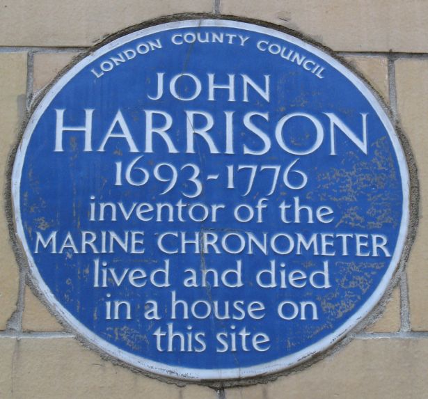
Note that Bowen was probably writing just before more accurate measurements of longitude were introduced by John Harrison https://en.wikipedia.org/wiki/John_Harrison.


7
Flat Earth Theory / Increased gravity at the poles?
« on: November 11, 2018, 11:45:23 AM »
From the Wikipedia article on Clairaut's theorem:
Quote
https://en.wikipedia.org/wiki/Clairaut%27s_theorem Although it had been known since antiquity that the Earth was spherical, by the 17th century evidence was accumulating that it was not a perfect sphere. In 1672 Jean Richer found the first evidence that gravity was not constant over the Earth (as it would be if the Earth were a sphere); he took a pendulum clock to Cayenne, French Guiana and found that it lost 2 ½ minutes per day compared to its rate at Paris. This indicated the acceleration of gravity was less at Cayenne than at Paris. Pendulum gravimeters began to be taken on voyages to remote parts of the world, and it was slowly discovered that gravity increases smoothly with increasing latitude, gravitational acceleration being about 0.5% greater at the poles than at the equator.
How would FE theory explain this result? As usual there are two questions (i) whether the observation is correct and (ii) if correct, how would FE theory explain the difference in gravity?

This is different from the height effect, whereby gravity decreases with height. This is explained by Celestial Gravitation. The Clairaut phenomenon, by contrast, is a surface effect, dependent only on latitude.

8
Flat Earth Theory / FE astronomy – apparent rotation of constellations
« on: October 29, 2018, 10:48:44 AM »
Choose any constellation due East or West on the horizon at a definite time. For example, in London the belt of Orion appears on the horizon, due East, at 21:07.
Using software such as Stellarion shows that Orion will appear to rotate anticlockwise as you change latitude, i.e. move due North or South. For example, at 80deg North, he is standing upright with his belt on the horizon. At 80deg South only the bottom half of his body is visible, with his legs sticking up in the air.

This is easily explained on the RE hypothesis. How can we devise an FE theory consistent with the observations. Some questions

1. Is the astronomical software correct? I.e. are the actual observations consistent with what the software imples?

2. Assuming it is, do the stars lie in a flat plane above the earth, or at different distances from the earth?

3. Do any of them lie beneath the earth at any time? This could easily be verified by observations at the same time at different time zones. (Note there can be no observers living below the flat surface of the earth).

4. Is there any observable stellar parallax? Standard astronomy says that none is apparent without accurate instrumentation. If so, the stars must either be a very long way away, or they lie in a plane, parallel to the surface of the earth.

5. If in a plane, how do we explain the Orion phenomenon? There was a similar phenomenon noted here about apparent moon rotation, which FE explains as the result of the bottom of the moon only being visible. Clearly if all the stars in Orion lie in a plane, we need to explain how the top half of Orion is visible only in the Northern latitudes, with the bottom half only visible in the Southern latitudes. We need a very complicated theory of perspective or light bending to explain this, but I am working on it.

9
Flat Earth Theory / Curvature visible to naked eye
« on: October 12, 2018, 04:33:43 PM »
Here’s an experiment I did on holiday by the sea, requiring no equipment.

1. Choose a day with little wind (although this doesn’t actually matter).

2. Look for a boat sailing out to sea, i.e. in direction of horizon, and wait until the bottom of the hull at the water line is just sitting on the horizon line.

3. Move your head down as close as possible to the surface of the water so you can still see the horizon line.

4. At that point you will see the hull disappear. Note, This is not because of any ripples or small waves at the foreshore. You should be able to see the whole surface of the water right up to the horizon line, but with only the mast visible.

5. If you move head up and down, you can actually see the bulge in the water, a few miles away by my estimate.

Hence, the water looks curved. Ergo, if it looks curved, it is curved.

10
Flat Earth Theory / Explaining universal acceleration
« on: July 29, 2018, 04:18:48 PM »
Quote
Objects on the earth's surface have weight because all sufficiently massive celestial bodies are accelerating upward at the rate of 9.8 m/s^2. The mass of the earth is thought to shield the objects atop it from the direct force of UA. Alternatively, it is possible that the force of UA can actually pass through objects, but its effect on smaller bodies is negligible (similar to gravity in RET cosmology, which only has a noticeable affect on very large objects).
https://wiki.tfes.org/Universal_Acceleration

Obviously at some point it occurred that if UA was actually universal, people sitting on top of the surface would be affected by it, so we would all be effectively weightless. Clearly we are propelled downwards when we jump off because while the ground is accelerating upwards, we remain at a constant velocity.

This is quite a conundrum. Some bits of matter are affected by UA, others aren’t. Which? Is it the earth and the rocks in it? Well not the immediate surface. If I pick up a rock and drop it, it falls just the same as me, at the same rate. What about below the surface? What happens in a mine? Do the bits of coal drop off the coal face just as they do on the surface? Apparently they do.

The article suggests that only ‘sufficiently massive’ objects are affected. But no explanation is given of the threshold size, nor of why the size would make a difference. Does the UA act on all parts of the massive object? If so, size would not matter. The force would act on each piece regardless of the larger body it was connected to. Or just one point? But why that point, and why does the earth not bend as a result of the push from that one point.

Separately, where does the energy come from to produce the acceleration? We know the earth is pretty massive, so the force must be massive too. Where does the energy come from? Doesn’t this violate the conservation of energy? If it does, why?

11
Flat Earth Theory / Is Google maps accurate?
« on: July 21, 2018, 12:30:12 PM »
The table below shows the results of the following experiment.
1. Choose a pair of cities, and take the lat/long of a point in each. (cols 1-6)
2. Use the haversine formula to compute the distance between those points. This implicitly uses the assumption that the world is approximately spherical. (Col 7)
3. Then enter the first lat long pair into the window of Google maps. Google understands that these are lat long coordinates, and marks a red point on the map. Right click on that point, and select ‘measure distances’. Enter the second pair, which takes you to the next place, then left click on the red marker. A window opens giving you the distance in km or miles. (Col 8 )

The results clearly indicate that Google maps is using round earth assumptions. So the question is whether Google maps is accurate or not. If it is, then the earth is approximately a sphere. If not, then not.

See my other experiment which was an attempt to correlate Google/Haversine with flight times.

City 1,   City 2,   Lat 1,   Long 1,   Lat 2,   Long 2,   Haversine,   Google
Sydney,   Melbourne,   -33.87,   151.21,   -37.81,   144.96,   713.43,   713.39
Frankfurt,   Warsaw,   50.11,   8.68,   52.23,   21.01,   890.12,   890.15
New Delhi,   Singapore,   28.61,   77.21,   1.35,   103.82,   4142.49,   4142.33
Mumbai,   Cairo,   19.08,   72.88,   30.04,   31.24,   4358.21,   4357.79
Perth,   Auckland,   -31.95,   115.86,   -36.85,   174.76,   5346.63,   5346.38
London,   Perth,   51.51,   -0.13,   -31.95,   115.86,   14478.80,   14478.92

12
Flat Earth Theory / Detailed flight times and distances
« on: July 19, 2018, 05:04:57 PM »
See below for a plot of flight distances versus flight times.

Methodology:
1. Take airport pairs where there is a direct flight from one airport to the other, and where a flight time is available. 354 pairs in all.

2. Obtain the latitude and longitude of each airport.

3. Use the Haversine formula to determine the distance in km between the airports, using the assumption that the earth is a sphere 6,371km in radius.

4. Plot the distance against the time (see below).

Observations
The distance assumption is clearly based on RE, however the flight time is simply the observed time taken (from published flight times admittedly, but any flat earth observer could easily check these by taking the flights). If the earth is an approximate sphere, we would expect to see a high but not exact correlation between RE distance and time.

The average speed varies between 288 km/h between Paris and Brussels and 939km/h between Jo'burg and Sydney. Generally for shorter times (less than 6 hours) the average speed falls. Hypothesis: this is caused by the time taken to reach maximum speed from zero. One could probably work out an exact relationship, I haven't tried.


13
Flat Earth Theory / Rowbotham on perspective
« on: July 14, 2018, 01:10:03 PM »
Rowbotham Chapter XIV:
Quote
Send a young girl, with short garments, from C on towards D; on advancing a hundred yards or more (according to the depth of the limbs exposed) the bottom of the frock or longest garment will seem to touch the ground; and on arriving at H, the vanishing point of the lines C, D, and E, H, the limbs will have disappeared, and the upper part of the body would continue visible, but gradually shortening until the line A, B, came in contact with E, H, at the angle of one minute. http://www.sacred-texts.com/earth/za/za32.htm

Is there any evidence for such an effect? Photographic evidence suggests not


Moreover, a theoretical reason is that, if the ground is perfectly flat, and if light travels in straight lines, light will follow a line drawn from the ankle parallel to the ground to a point above the level of the ground where the observer is positioned. So the observer will see the ankle.

This requires only one assumption, namely that light travels in a straight line across the earth.

14
Flat Earth Investigations / Euclid's parallel postulate
« on: July 02, 2018, 05:54:39 PM »
Some quotes related to Euclid's parallel line postulate courtesy of the Department of Mathematics at UC Riverside:

http://math.ucr.edu/~res/math133/geometrynotes05a.f13.pdf

Quote
We have already mentioned in Section II.5 that the final assumption in Euclid’s  Elements  (the so – called Fifth Postulate) is far more complicated than the others. Furthermore, the proofs of the first  28 results in the Elements do not use the Fifth Postulate. In addition, there are general questions whether this postulate corresponds to physical reality because it involves objects which are too distant to be observed or questions about measurements that cannot necessarily be answered conclusively because there are always limits to the precision of physical measurements.

A nice quote from Immanuel Kant:

Quote from: Immanuel Kant
"The concept of [Euclidean] space is by no means of empirical origin, but is an inevitable necessity of thought."

Kant, Critique of Pure Reason (1781)

A good description illustrating the parallel line postulate.


As we can see, it is candidly admitted that this idea is not empirical. It is a hypothetical house of cards.

Is your point that parallel lines do meet after all?

15
Flat Earth Theory / Full moon impossible?
« on: June 23, 2018, 07:52:48 AM »
The wiki argues that a full moon is impossible.
https://wiki.tfes.org/The_Full_Moon_is_Impossible_in_Round_Earth_Theory

However, the scale of the drawing is misleading. The sun, moon and earth do not lie at anything like those distances. The ratio between the distance of sun to earth, and the earth’s diameter is something like 12,000.

So, while still not nearly the right scale, I suggest it is more like this.
Thus it is perfectly possible for all the area of the moon visible from the earth to be fully lit by the sun, i.e. 100% ‘full moon’.

16
Flat Earth Theory / What do we all agree on?
« on: June 11, 2018, 09:15:58 AM »
Points on which we may all agree.

1. Every point has a distinct longitude and latitude. A longitude is a line where all sundials are showing the same time. A latitude is determined by the angle to the pole star (in northern side of earth) or by angle to southern axis of apparent celestial rotation.
2. Longitude lines are straight, in the sense that they are the shortest distance across the surface of the earth between two points on the longitude line.
3. Longitude lines all intersect at the geographic north pole (and perhaps at the south pole, but that depends on the model chosen)

Where we may disagree

4. The surface distance between lines of latitude is about 111km per degree, for any latitude whatsoever.

17
Flat Earth Theory / The Circularity Objection
« on: June 07, 2018, 09:41:45 AM »
Right, but in order to convert lat/lon differences into a straight line/great circle distance, one must first agree upon the shape of the Earth (you refer to that yourself as "knowing how far apart lat/lon points are"). Using it the way you propose would reduce your argument to "the Earth is round, therefore these are the distances, therefore the Earth is round"
This is an excellent formulation of what I call the circularity objection. You hear it many times from Flatearthers: the model RE is using to prove some point itself assumes an RE model, so the proof is circular, or question begging.

Now it’s true that if I worked out a distance between two lat/lon coordinates by using spherical assumptions, then used that distance to ‘prove’ RE, that would be highly question-begging.

But what if I work out the distance in another way? The original way that (short) distances were accurately worked out was by a chains, literally a chain of links spread out on the earth’s surface like a big tape measure.

First question in this debate: do we all accept that a measurement essentially like a big tape measure, perhaps suitably adjusted (I will come on to that later) is indifferent to the shape of the earth, and distances based on this are not circular?

If not, what other measure of distance would you use? Car odometers are actually the same form of measurement – a bit like rolling up the tape measure for every turn of the wheel and reusing it.


18
Flat Earth Theory / Do constellations remain the same shape?
« on: May 28, 2018, 06:46:35 PM »
Celestial globe below. Whatever our model of reality, I think we have to agree that all the stars appear to move together. The constellations stay the same shape whatever the time of night. So if our model is geodesic, we have to assume that the whole heaven is a sphere, and disappears underneath us when it is no longer visible, as opposed to remaining on top of us but somehow out of sight.

I am not taking any view here. I would just like Flatearthers to explain this observation. How is it that all the stars appear to move together?


19
Flat Earth Theory / Latitude and Longitude
« on: May 27, 2018, 08:02:29 AM »
Found on YouTube:

‘Latitude and Longitude are concepts that originate with Astronomy and which assumes that we live on a spherical surface’.

As far as I can determine, the second part is not correct. The first part is misleading, given that the practical application of of these measurements is for navigation to avoid ships crashing into land.

The second part is wrong. No such assumption is required. Latitude is an observable quantity based on the sun’s position. Longitude requires an accurate clock and a measurement of local noon.

Both are therefore measurable quantities, and so don’t depend on spherical earth assumptions. Of course, a spherical earth is a consequence of this, but a consequence and an assumption are quite different things.


20
Flat Earth Investigations / Is surveying an accurate science?
« on: May 25, 2018, 10:12:20 AM »
This was questioned in an earlier thread. ‘Accurate’ is relative, of course. There is accuracy down to the molecular level, and there is accuracy for the purpose of everyday measurement.

With the help of my late father-in-law’s theodolite, which I am just beginning to understand, I can determine this. The first picture below shows the whole instrument. It was made by Clarkson and co Holborn, and the case says it was inspected 17th April 1962. Incidentally, my father-in-law worked for the British government, travelling to distant places to check the amount of land the government owned or controlled. I don’t know if he was in on the conspiracy, he never mentioned it.

You should just be able to see the bubble in the spirit level, which I set level before the photo was taken. This was done by turning the dial in the second picture. The idea is that when the bubble is in the centre, the optical tube is absolutely level, i.e. on a line perpendicular to the force of gravity, and any object appearing in the horizontal crosshair will lie on that line. It follows that if the horizon appears below the horizontal crosshair, it does not lie on that line. Rowbotham claimed that there were ‘collimation’ distortions in such instruments, but haven’t seen any evidence so far.

The instrument says that each division on the spirit level corresponds to 30''. I looked this up and this means 30 arcseconds, i.e. 0.3 of an arcminute, where an arcminute is 1/60 of a degree. If you think back to schooldays, one degree is pretty small, and 1/60 of a degree much smaller than that. I now need to work out how much difference that division would correspond to over 30 miles.

More schooldays. 30 arcseconds is 0.000145444 radians, 30 miles is 5,280 feet. Therefore to work out how much the 30 arcsecond division on the theodolite corresponds to, I use the tan function to convert the angle in radians to get the opposite/adjacent ratio. Then I multiply this ratio by the adjacent amount (30 miles in feet) to get the error in height. This works out to 23 feet. The question is whether we could live with that. Of course this is not a super high precision instrument. That said, when I levelled it, even a small pressure on the desk, even changing position in the room, caused a noticeable movement in the bubble.

Later on I plan to take the instrument to the North Kent coast where the wind farm and the Shivering Sand fort are a known distance from the coast.


Pages: [1] 2  Next >