Show Posts

This section allows you to view all posts made by this member. Note that you can only see posts made in areas you currently have access to.


Messages - DuncanDoenitz

Pages: < Back  1 ... 6 7 [8] 9 10 ... 17  Next >
141
Flat Earth Theory / Re: Found a fully working flat earth model?
« on: February 15, 2022, 10:22:00 PM »
You're using a straight ruler. 

Fully working model, but you need a fully working stretchy-bendy ruler. 

142
Flat Earth Theory / Re: Found a fully working flat earth model?
« on: February 13, 2022, 09:14:07 AM »
Fine, but we live in the warehouse.  We can walk around it, climb it, measure it.  Its a warehouse.

143
Flat Earth Theory / Re: Found a fully working flat earth model?
« on: February 12, 2022, 08:36:46 PM »
@Troolon; can we go back around 5 pages to our carpet-fitting business? 

It turns out that we are quite the success story, and we have expanded into carpet production and installation; our factory in the West Midlands of England receives orders from far and wide, including from the Lord Mayor of Hobart, Tasmania, who wants to carpet his office.  We send out a technician to measure-up and (conveniently) he finds the office to be exactly 3m x 4m, with diagonals of 5m, so it's precisely a right-angle rectangle.  Our representative makes a drawing of the office floor and e-mails it to Company HQ. 

Question 1; Hobart is around 42 deg S latitude.  At what point, if at all, should our technician be using bendy rulers or variable-scales to draw his map, because the drawing is, after all, a map? 

The federal Australian government gets to hear about the Lord Mayor's carpet and they are well impressed with the quality, precise manufacture to specified dimensions, and its absolute resistance to stretch and shrinkage.  It can be rolled up, but it is incompatible with curvature in more than one dimension. 

In an effort to brighten up Australia, they decide to cover the complete country in a nice floral pattern axminster.  A rectangular remnant precisely 3000km x 4000km should do it, and extend a little over the coast.  So we manufacture a carpet loom 3000km wide, and use it to produce a carpet 4000km long.  We know it is a precise right-angle rectangle, because the loom is precisely 3000km, and with our top-notch quality control (the technology of which which we can leave someone else to work out) we used it to produce a carpet exactly 4000km long, without any warpage whatever.  We ship it off to Canberra.  (Again, we can leave the logistics to FedEx or whatever). 

So now the Aussies roll it out from Brisbane towards the West. 

Question 2; How does it look?  Is it wrinkled at the edges?  Is there a ridge over Melbourne? If we push it down over Victoria, does it leave a gap over Sydney?

Perhaps it lies perfectly flat; no gaps.  We have proven that the Earth is flat, or cylindrical, or a cone, or a pyramid or some-such.  We possibly don't know which, but we have completely refuted the idea that the world is spherical, or shaped like Angela Merkel.  If we continue to identify what shapes it isn't, eventually we will know what shape it is. 

Confession time; unbelievably, the above story is not true.  (We went bust in the first year; the clever money, apparently, is in laminate).  The point though, is that as a thought experiment it is true.  If we did it, either the carpet would lie flat, or it wouldn't.  It can't do both.  It would falsify one part of the argument. 

Your contention that we cannot know the shape of anything is a nonsense.  Its not just about the maths.  The Earth, like our fictional carpet, is an entity with fixed dimensions.  If we measure it enough ways, using a constant metric against entities who's size we know, we can know its shape or, at the very least, identify what shape it isn't. 
144
Flat Earth Media / Re: New Photos of Moon suggest Flat Earth?
« on: February 09, 2022, 09:19:16 PM »
Obviously they are using a lens with a long focal length, so distant objects look closer to each other.  Its the same reason that Formula 1 cars look closer together and travelling slower when the TV camera zooms in to the far end of a long straight.  And how do we reconcile a satellite at an altitude of "several million miles" with a flat-Earth dome? 

Also, I think you mean the far side of the moon.

There is no Dark Side of the Moon really; as a matter of fact, its all dark. 

145
Flat Earth Investigations / Re: ISS 2031
« on: February 04, 2022, 03:30:19 PM »


1) Let if drift off into space.
2) Hit it with a missile and let all the little pieces disintegrate in the atmosphere.
3) Detonate it with a bomb and let all the pieces disintegrate in the atmosphere.
4) Leave it where it is in orbit.


I don't think you're really trying here. 

1.  Its in LEO.  It would require a lot of energy to launch it into free space. 
2.  Most of the pieces would remain in orbit, adding to the space trash problem. 
3.  see above. 
4.  Its orbit will eventually decay, leading to random impact with the schools, orphanages and so forth already mentioned. 

146
Flat Earth Investigations / Re: ISS 2031
« on: February 04, 2022, 01:58:57 PM »
So they could just leave it up there beyond 2031.  Just have to keep putting new batteries in the Firmament Projector Thingy.  Wherever that is. 

And you do understand that, as it breaks up, the different components, having a wide variety of mass/Cd ratios, will be spread over a large area, of which Point Nomo is the centre?  It won't conveniently land in one lump, hence maximise the chances of hitting no-one (or Nemo). 

147
Flat Earth Theory / Re: Found a fully working flat earth model?
« on: February 01, 2022, 11:46:29 PM »
This is nonsense.
A square has certain properties - 4 equal length sides, 90 degree corners. These are physical things which can be measured.
If the four sides are different lengths - compared to each other - then it's not a square.
If the angles are not all 90 degrees - which is a definition, and the angles can be compared against each other - then it's not a square.
You can define these things in different ways, but that doesn't mean the different things equivalent.
Math doesn't care how you draw things. It can't see. For math all these shapes are rectangles.
For an observer inside the coordinate system, all these shapes are also rectangles.
For an observer outside of the system, none of these are a rectangle.
This is the way we construct our universes. From the inside they're identical to globe physics, they're only different from the outside.
But as they're all identical on the inside, we can never know the true shape of the universe.
I assume you are not a carpet fitter by trade. You would experience some very surprised customers. 

If that sounds facetious, it isn't meant to be.  Forget the complex maths (and I'm not convinced that you're not trolling), but if you can't get your head around the practicality of measuring something you are physically experiencing (be it with a straight ruler, odometer or whatever), and transferring those dimensions onto a model with which you are interacting (be that an engineering drawing, map or mental concept), I don't think you are really in a position to postulate the shape of the cosmos. 

148
Flat Earth Theory / Re: Found a fully working flat earth model?
« on: January 31, 2022, 10:45:33 AM »
The map has a different distance metric. Distance is just a formula, it's up to you to choose a meaningful one.
Using the correct metric, the circumference of 80N and 80S is the same as the globe and so it's smaller than the equator.

I believe you might be taking an orthonormal straight ruler and be applying it to a non-orthonormal basis and saying everything's wrong.
Flat earth rulers are curved, the markings are not equally spaced, and you need a different shaped ruler depending on position and direction you're measuring. (not very practical but that's flat earth for ya)
If i were to take this flat-earth ruler to the sphere, it won't make any sense at all either.


If the Earth is flat, then any flat map (on paper or screen) is just a scale drawing, with a constant scale.  No need for bendy rulers. 

The scale is n, map distance is y, and actual distance is x.  If your formula is more complex than  x=ny, then the Earth isn't flat.

149
Flat Earth Theory / Re: Where is Google Maps wrong?
« on: January 28, 2022, 05:33:02 PM »
@Jimster; concur with 95% of your post, but could you clarify this  "came within a few miles of what they saw on their cell phone gps"

Whilst I would find some novelty value in comparing my solar-calculated position with that on my cellphone (assuming pre-loaded with suitable mapping), I find it difficult to believe that a 21st Century transatlantic navigator would not be also be equipped with a dedicated marine-GPS as a reference source of navigation data. 

Do you have a link to the You Tube video?

150


I left my camera to create an exposed shot to capture on its own; that doesn't mean that I didn't try it a bunch of times, that I didn't go to great lengths to create artificially good conditions, or that I didn't put it through extensive editing to unnaturally make what I wanted.
What exactly are "artificially good conditions"?  Do you mean "with precision"?   

I have a precision timepiece.  The drawback is that it only tells the correct time if I set it with precision or, perhaps in your vernacular, "artificially good conditions". 

151
Flat Earth Theory / Re: Where is Google Maps wrong?
« on: January 19, 2022, 06:09:28 AM »
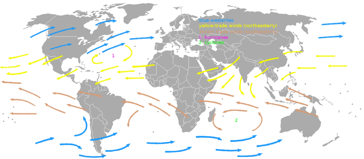
@Gonzo: although the numbers may vary, I think 'RE and FE are in broad agreement that eastbound transatlantic traffic gets a benefit from wind in terms of speed, range and fuel-burn.  Tom's contention, however, is that traffic from Europe to North America also consistently gets a benefit from easterly winds.  Any comment?

152
Philosophy, Religion & Society / Re: Britain's Pedo Prince
« on: January 17, 2022, 10:04:58 PM »
All of the British royals are pedos.
All of the American Royal Family would be pedos.  The British Royal Family are paedos. 

153
What you are talking about is the difference between True Airspeed (TAS) and Indicated Airspeed (IAS).  IAS is what is shown on the pilot's Airspeed Indicator, and is important for the aerodynamic handling of the aircraft, but at high altitude it is significantly lower than the TAS.  If you like, IAS is the number of cookies per second, but is less than the actual speed.  TAS is used for navigation, and is the maximum speed quoted by the manufacturer. 

What this means in practice is that the aircraft is faster at altitude, as you suggest, but this is already the limiting speed quoted by the manufacturer.  If the limiting TAS is, say 500 knots, the pilot might reach this speed when he sees only around 300 kts on the Airspeed Indicator. 

Its not that the aircraft is exceeding this limiting speed at high altitude (low air density), its just that the pilot is actually seeing a lower figure for IAS.  The minimum air density (in other words is maximum altitude) is specified, again, by the manufacturer. 

It is quite categorical.  The aircraft will not travel through the air, at any density which it is certified, faster than the manufacturer says. 


154
Flat Earth Theory / Re: Where is Google Maps wrong?
« on: January 01, 2022, 10:05:16 AM »
There are winds which travel both Eastwards and Westwards in both the North and the South. There is no such thing as not taking advantage of any winds for a control flight. The planes always try to take advantage of the winds when they fly. When traveling from New York to Europe the planes fly North along the track and when they fly from Europe to New York they fly over a thousand miles south to take advantage of the opposite winds.


(my bold); Why do you invent these things?  That, sir, is complete fabrication, and obvious to anyone who flies or watches a flight-tracking service. 

Currently; ETH552, UAE9249, PLM999, MPH6161 for example; all travelling Europe-North America, and all mixed in with West-East traffic. 

155
Flat Earth Theory / Re: Where is Google Maps wrong?
« on: January 01, 2022, 08:11:12 AM »
There isn't actually any reliable way to measure the distance between two distant points. Planes and ships are liable to be behind or ahead, and pilots strategically use jet streams to reach distant points. Most of the long distance flights typically pointed out wouldn't be possible without jet streams. The pilots travel between the coordinate points. And the coordinate points are based on the position of Polaris or time zones.

The only reliable distance measurement method is an odometer, and people haven't measured large portions of the earth with it.
Most, if not all, of the long distance flights typically pointed out have return legs that are not aided by jetstreams.  Pilots know the distance.  That s how they know how much fuel they need and when they will arrive.

156
And, by the way, what research brought you to the conclusion that there are now no 17000 mph winds around the Arctic?  A few posts back you seemed convinced. 

157
Duncin one of the first things you say in your earlier post was that my hypothetical plane travels a few hundreds miles an hour before hitting a 17,000mph jet stream at which point it goes 17,600mph.

That is opposite of what Ive been trying to say in my last three posts and the reason I made the Cookie chart to begin with!  Again, there's no wind near the poles (that I'm referring to anyway)!  I'm only speaking of aero and engine capacity. 

And thank you for correcting me on the second chart.  I'd just say that once you get a 747 going having a million pounds of thrust will still get you places fast.   

And stack, calling everybody a liar when you confront something you don't understand is not useful.  I plan on looking more into the instruments aviators use to calculate speed etc, but for now I'm going to bed and I wish you guys a happy New year.
And a Happy New Year to you too.

It's not a million pounds of thust.  It's  million Newtons.  Please read your chart.  And 200 million pounds, Newtons or mega-watts can only push the plane through cookies as fast as Boeing, Airbus, Stack and others have already told you, the aircraft has a structural limit. 

158
Guys, there's a big misunderstanding.  I'm trying to make the point that I no longer believe that Jet Streams are responsible for the very fast plane speeds we see near the Polar Regions on a Flat Earth.  Rather, it's the thin air that allows these planes to travel so fast.

Below is a simple example to help answer some of your questions:  At the top, plane one is flying through 10 cookies in about 10 seconds.   And plane two is also flying through 10 cookies in 10 seconds!  The only difference is that plane 2 needs to fly faster!  That means that lift and air pressure and drag are presumably the same for both planes.


To propel Plane 2 to such great speeds, you need to assume their jet engines are producing enough thrust in these conditions until the aircraft reaches its structural limit.  I don't know the ins and outs of Jet Engines, but so far, they seem similar to Rocket's and in some cases produce more thrust (Scram jets anyway).  The Boeing 747 has a power to rate ratio greater than an SR-71 - One of the fastest Jet Planes to ever fly. 


https://simple.wikipedia.org/wiki/Thrust

(Sigh).  This doesn't get any easier. 

That chart isn't the thrust-to-weight ratios of the aeroplanes, its just the thrust to weight ratios of the engines.  The engines of a 747 don't go anywhere without the rest of the 747 attached to them.  All 400 tons of 747.  I'll let you re-do the maths if you think it has any merit.   

And I see what you're trying to say with the cookies, but we already discussed this.  Go back a couple of posts, and where I wrote "air density", read that as "cookie density".  Does that make any sense? 

159
Flat Earth Investigations / Re: Weather forecasts
« on: December 31, 2021, 04:57:38 PM »
Soooooo, where are we. 

Its New Years Eve and, if the good Meterologist-Captain-Doctor's second tile is to be believed, the UK was predicted to have temperatures today higher than Spain. 

From METARs at 16.30 utc; London City Airport = 15 C.  Malaga Airport = 14 C.  (and definitely unseasonably warm in NW England). 

Gotta say the Climate Change and Covid things have muddied the waters somewhat, so I don't honestly know where this leaves the Weather Guys' evil master-plan for world domination. 

Of course, that still leaves his first tile out in the cold (pun intended), but as the 96% scoring CPL-holder neglected to specify a timeframe more accurate than "next week", I guess we'll just have to watch the skies.  And wait. 

edit; this news just in .....

https://www.bbc.co.uk/news/uk-england-somerset-59840877


160
It's the increase of airspeed which gives the aircraft lift in thin air.

And it's Newton's 3rd law of action and reaction I was referring to.  NASA explain that it's like a person standing on a skateboard and by pushing a bowling ball outwards with his hands can generate movement.
I don't think you're really following this. 

The plane takes off, climbs, and then cruises through average-joe atmosphere at an airspeed of (let's say) 600mph.  It enters your hypothesised super-jetstream which has a speed of (let's say) 17000mph; its ground speed is now 17600mph but its airspeed (the one that affects aerodynamics) is still only 600mph, so there is no change to lift or drag. 

And NASA is describing a jet, or rocket, engine.  The "bowling ball" is the exhaust gas. 

A rocket engine burns its self-contained fuel/oxidiser and accelerates the exhaust gas to phenomenal speeds (perhaps more like skateboard guy firing a baseball with a grenade launcher).  Airliners do not have rocket engines. 

A jet engine gathers atmospheric air and uses a compression/combustion process to accelerate it to lower speeds than a rocket, but in comparatively huge quantities (hence a bowling ball in our comparison) to achieve the same thing.  It needs to gather sufficient air, which is why airliner engines have such a huge frontal diameter, but they can still only operate in air which has sufficient density. 

Pages: < Back  1 ... 6 7 [8] 9 10 ... 17  Next >