21
Philosophy, Religion & Society / Re: Trump
« on: April 12, 2024, 02:55:20 AM »
It's clearly the beginning of the end for Donald Trump.
This section allows you to view all posts made by this member. Note that you can only see posts made in areas you currently have access to.
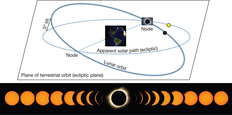
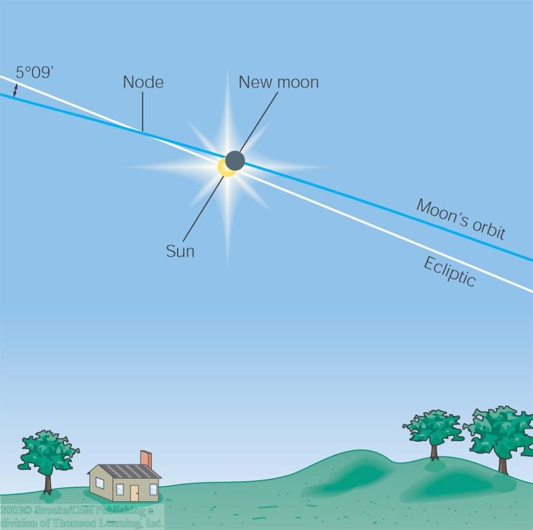
It is the fact that you have objects orbiting and rotating on different planes that gives you the answer to your question.


It mentions it just after 3 minutes in.


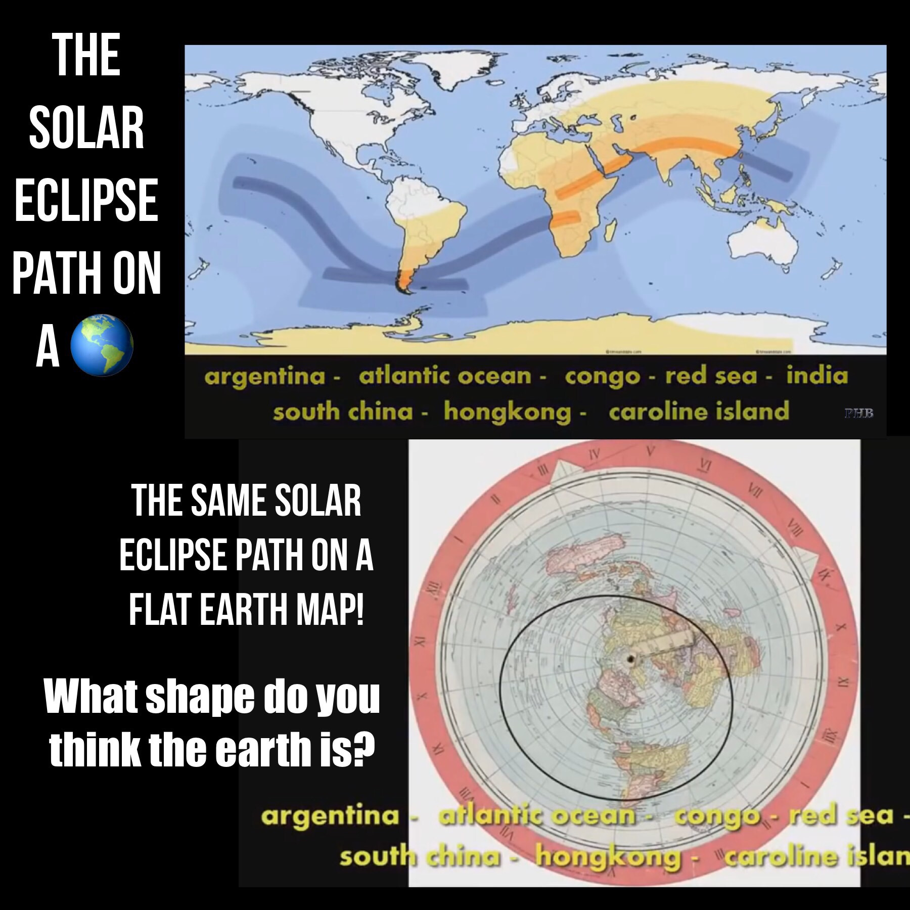
To understand this just put Google Earth in Globe mode, define some straight lines across the globe and then go back in to map projection mode. Voila:
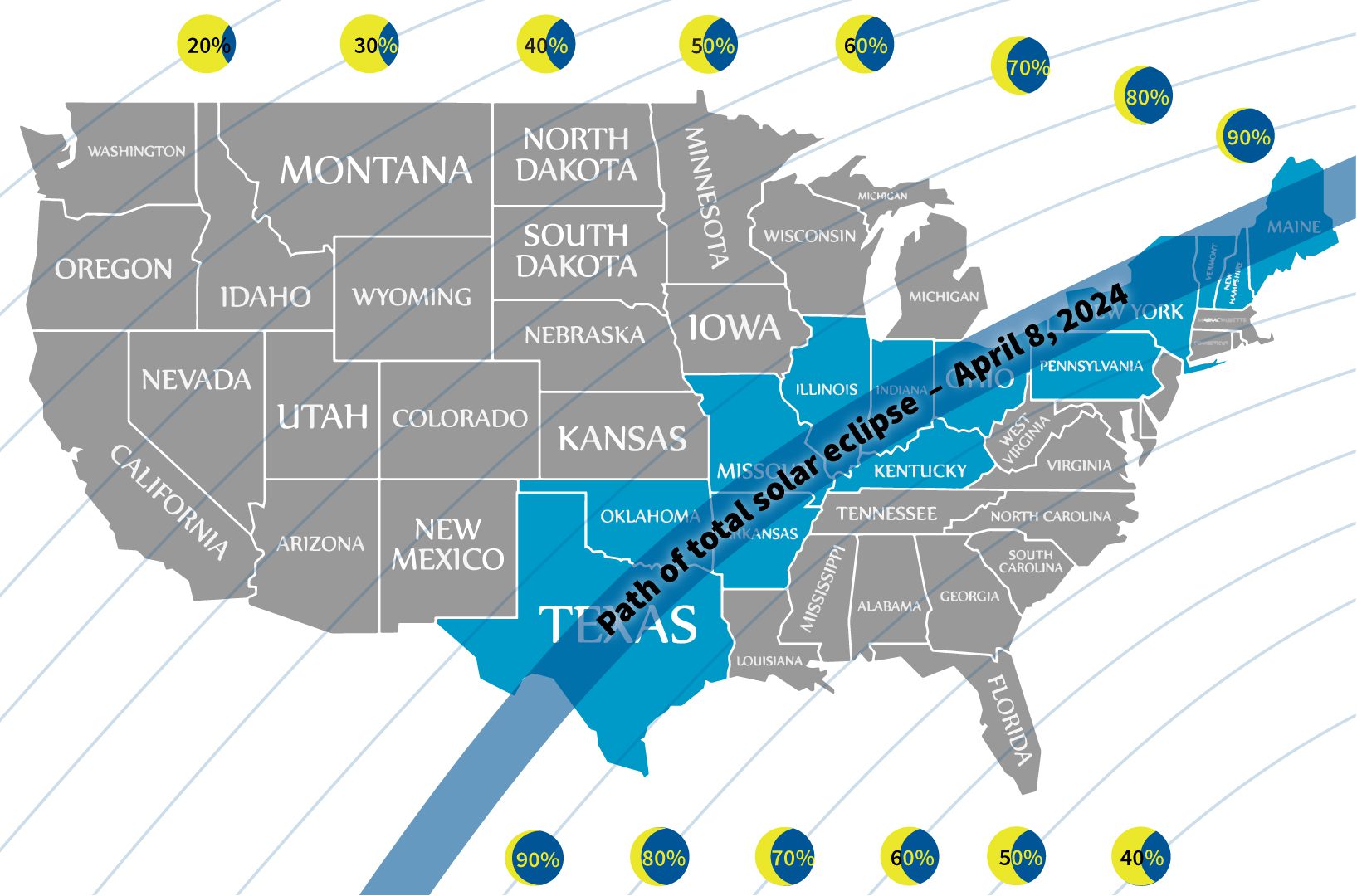
Basically, it's a 2D line - the shadow path - mapped on to a 3D object - the globe - which is also spinning. And the rate of that spin varies with latitude.
It's a bit complicated, but if you look at the example at just after 3 minutes in to that video you can have a go yourself to help you understand it. A lot of your FE belief seems to stem from you not understanding the RE model and thus declaring it impossible.
The Solar Eclipse eclipse paths on a Flat Earth make more sense to me than the Solar Eclipse paths on the Round Earth.
I think I've identified the issue.
This is a bit complicated but this video does a reasonable job of explaining it:
The headline is that straight lines when mapped on to a globe aren't straight when shown on a 2d map projection.
And the earth is rotating at different speeds at different latitudes, which complicates things.
Also note that the width of the eclipse path changes with latitude. The size of the shadow isn't different, it's just that the angle of the earth's surface with respect to that shadow is different which means it can be seen over a wider area.
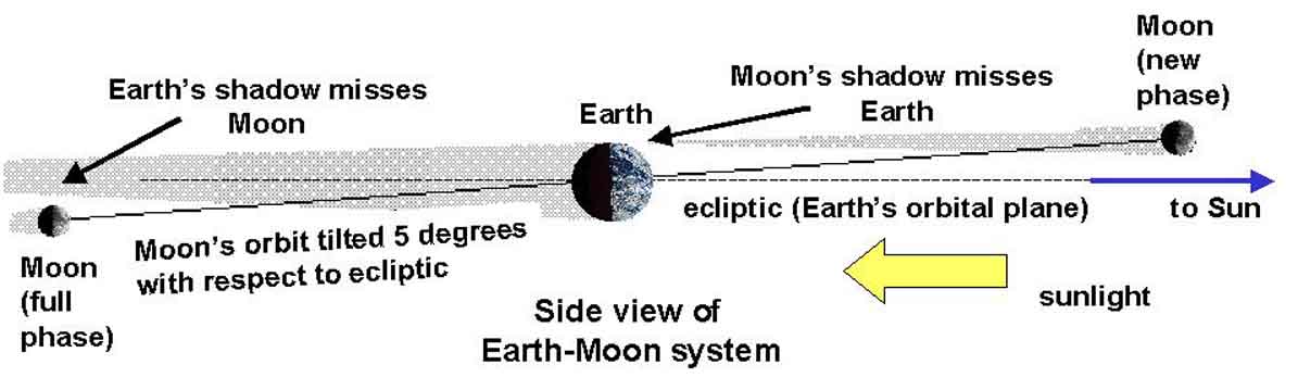
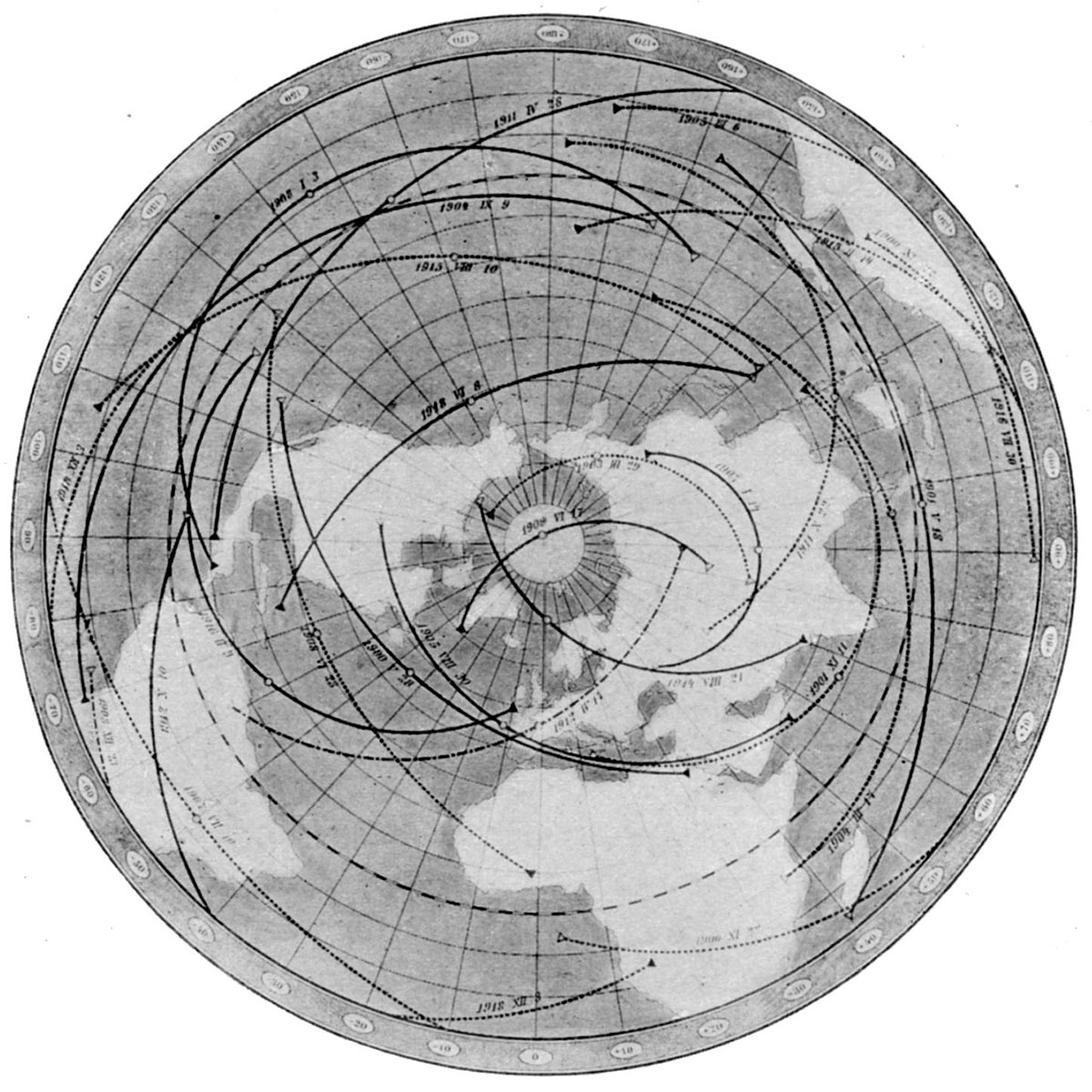
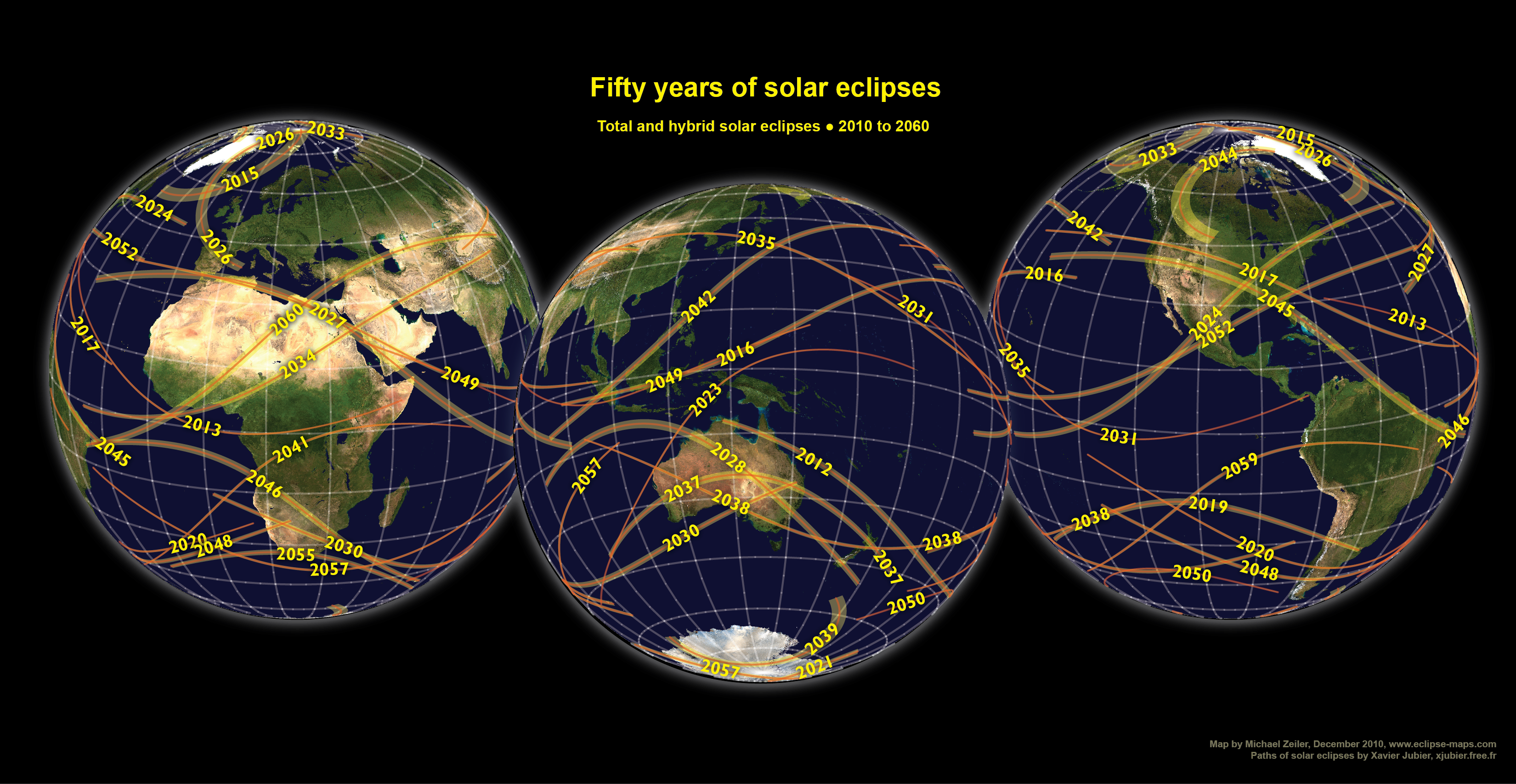
Fig. 36.—Central eclipses for the first two decades of the twentieth century. Oppolzer.
Future eclipses.—An eclipse map of a different kind is shown in Fig. 36, which represents the shadow paths of [pg. 114] all the central eclipses of the sun, visible during the period 1900-1918 A. D., in those parts of the earth north of the south temperate zone. Each continuous black line shows the path of the shadow in a total eclipse, from its beginning, at sunrise, at the western end of the line to its end, sunset, at the eastern end, the little circle near the middle of the line showing the place at which the eclipse was total at noon. The broken lines represent similar data for the annular eclipses. This map is one of a series prepared by the Austrian astronomer, Oppolzer, showing the path of every such eclipse from the year 1200 B. C. [pg. 115] to 2160 A. D., a period of more than three thousand years.


https://twitter.com/markets/status/1772341311481266619


