1
Flat Earth Community / Re: If you could who would it be.
« on: March 01, 2020, 03:03:24 PM »
How about Sandokhan?
This section allows you to view all posts made by this member. Note that you can only see posts made in areas you currently have access to.
I’ve come to understand that most people who believe the FE theory also believe the moon landing was faked. So, if NASA was willing to fake that big achievement, why is it that they haven’t done anything consequential, real or faked, in such a long time? Did they decide to stop faking it?
Sorry if this is in the wrong section, I’m new to the forum.
We see a spherical Sun, we see a spherical Moon and when I look at the planets through my telescope I see them as spherical too. In fact nothing else in the Universe, regardless of which direction we look is actually flat. Apart from the rings of Saturn and they are not flat in reality.
So if I can ask a simple question then, why should the Earth be flat, who was the first person to suggest it is and why?
Surely some one on the flat Earth side can answer this? You say you believe the Earth is flat but you don't say why? I realise that the FE Wiki page states things like the Earth looking flat etc etc but that is neither evidence or proof. So why should the Earth be flat?
How very adult of you.
About as adult as ignoring a simple yes or no question.It's not a yes or no question.
This is, very clearly, a yes or no question:
Do the Bing maps, which represent the earth as a flat plane, not count as FE maps because the map website says they are based on a globe projection?
Yes =Bing maps DO NOT COUNT as FE maps
No = Bing maps do count as FE maps
Yes you can, IF you consider the frisbee just a very small part almost flat of a large spherical object.
I think I understand what you mean. As if the frisbee was just a small part of a much larger sphere. Would that mean then that you would only be using a small portion of that measurement system (like coordinates)?
Yes, if you see an egg-shell through a microscope, what you see on the lens can receive plotted coordinates almost as a flat surface, lines almost parallels and perpendiculars, no visual perceptible curvature. Remember from geometry school, a circle is composed by infinite quantity of small straight lines.
Also remember, a curve is a line that you can measure and determine it is not straight. If you can not show or prove it is not straight, then for your point of view it is a straight line. May be that line is a crooked all warped through stars and galaxies, but this small segment you see may be straight.
For example, the horizon is a straight line for the observer, if the observer can see the horizon in front, sides and back of himself. If the observer moves very far away from inside of this flat circle, then he can see the circle edges and find out he was indeed inside a circle. It is all a reason of what you see and how you can measure.
Other than that, in true nothing in the universe is straight, not even light travelling for eons, everything is under the influence of some gravity, space/time deformations. Think about your home window glass, it seems straight and flat, but it is not. It was produced using molten glass over a tank of liquid molten tin metal, liquid glass floats ove the metal, becomes flat and smooth. But due the Earth's spherical format and gravity, that liquid tin metal surface is not truly straight, it is curved - the center will always be bulged, non even close to visually perceptible angle, but it is measurable with precise instrumentation.
-I've heard rumors. Is the map really based on a flat Earth model?
No. The Earth is a globe.
If you think about the FE model to be like a pizza, and start to draw countries and continents based on known true distances, inland and between them, this pizza will end up missing few slices. Flat Earth model has a huge problem here. Someone (FEt) must fix this issue very soon.
The biggest problem that I've seen is that, if the map is not interactive, it always get proven incorrect by
Yes you can, IF you consider the frisbee just a very small part almost flat of a large spherical object.
It seems to me to be a pretty straightforward case this. Lunar eclipses can only occur and do only occur when there is a full Moon. A full Moon occurs when the Earth lies directly between the Sun and the Moon. A shadow always points in the opposite direction to where the source of light is.
So IF the Earth is in orbit around the Sun AND the Moon is in orbit around the Earth at a slightly different inclination to the Earths orbital inclination around the Sun then you would only get lunar eclipses during some months and not others. Also the Earths shadow would always lie opposite the Sun in the sky (the anti-solar point). Hence every day at Sun set the Earths shadow rises. When the Sun rises the Earths shadow sets. This is an exact description of what we see in the sky. Any FE people please say if I'm wrong there.
It is common sense then to suggest that a lunar eclipse is caused when the Moon moves across the Earths (otherwise invisible) shadow. No need whatsoever for any shadow object as you call it.
I know what you are trying to say here, but it still doesn't work without distortion. Take Wyoming for example. In Bing maps, Wyoming is depicted as a perfect rectangle (90 degree angles), no matter what zoom level you're at. But in reality, (looking straight down at it) Wyoming is actually trapezoidal, with an ever-so-slightly curved top and bottom. The northern border is 342 miles wide, while the southern border is 365 miles wide.
Google maps which represents the earth as a perfect sphere also shows Wyoming with 90 degree angles. Do you have any map or globe that shows wyoming as you describe
Looks trapezoidal to me. There may be approximately 90 degree angles on the corners, but the north and south aren't straight lines. They bow outwards and inwards, respectively. That makes it possible to have a trapezoidal shape and have right angles.
Your claim was that the Wyoming border does not have 90 degree angles. Google maps which represents the earth as a perfect sphere also shows Wyoming with 90 degree angles. Do you have any map or globe that shows Wyoming as you describe?
I have to ask again because when i asked the first time you didn't reply with a map or glove which shows Wyoming without 90 degree angles. You replied with your opinion about the angles.
I know what you are trying to say here, but it still doesn't work without distortion. Take Wyoming for example. In Bing maps, Wyoming is depicted as a perfect rectangle (90 degree angles), no matter what zoom level you're at. But in reality, (looking straight down at it) Wyoming is actually trapezoidal, with an ever-so-slightly curved top and bottom. The northern border is 342 miles wide, while the southern border is 365 miles wide.
Google maps which represents the earth as a perfect sphere also shows Wyoming with 90 degree angles. Do you have any map or globe that shows wyoming as you describe
In that case, please show us this unbroken line on your Bing map. Please take a screenshot of your Bing map and draw over it a hypothetical trip from New York to London to Tokyo to LA and then back to New York. The trip should go Eastward and must not be broken. And just to save us an iteration of this nonsense, please don't try to use the excuse that you can dynamically scroll the map to make the trip by a series of unbroken lines. I asked for a single unbroken line.2) Is it possible to trace the line of such a circular East-bound travel on either of these maps with an unbroken line?Yes.
I have already done this here:
https://forum.tfes.org/index.php?topic=14046.msg187564#msg187564
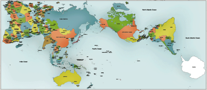
Here is an undistorted 2D map of the earth. By your logic the earth must be flat. I believe you are incorrect to make assumptions about the shape of the earth based on a map. The earth could be flat or a sphere or an oblate spheroid and we could draw a map of it.
No. I don't agree. Just because a map has a scale which changes does not mean that the earth is a sphere. The earth could be more shaped like a dinner plate or some other shape which is more "flat" than a sphere and have an interactive scale.
To simplify the calculations, we use the spherical form of this projection, not the ellipsoidal form. Since the projection is used only for map display, and not for displaying numeric coordinates, we don’t need the extra precision of an ellipsoidal projection. The spherical projection causes approximately 0.33% scale distortion in the Y direction, which is not visually noticeable.
My definition of a flat earth map is a map which represents the earth as a flat plane which can be verified as accurate.
When I use my eyes I can clearly see that Bing maps represents the earth as a flat plane. When I zoom all the way out i can plainly see a flat plane. There are many ways to draw a map in which the earth is shown as a flat plane.
By your logic there is no flat earth map. They are all projections of a sphere earth.
Take a look at this website:
https://www.google.com/maps
Zoom all the way out. This website represents the earth as a sphere.
By your logic there is no flat earth map. They are all projections of a sphere earth.
A big part of the problem is that there are at least a dozen different flat earth maps that I've come across and only one that I've found is supported by modern cartography, shipping, flight, and travel data.
https://www.bing.com/maps